
Licensed land surveyors providing accurate, council-ready plans for homeowners, builders and developers across Melbourne’s northern and western suburbs.
Confirm exactly where your title boundaries sit before you build, fence or resolve a dispute with neighbours.

Detailed site information for architects, designers and town planners, including levels, features and site context.
Surveying and plan preparation for land splits, boundary realignments and consolidations across north and west Melbourne.
Accurate set-outs and final as-built plans so your project is built where it should be and matches approved designs.

Tailored survey solutions for legal, commercial and complex property matters.

Tell us what you’re planning and we’ll recommend the most suitable survey in plain English.
Survey plans sit at the heart of most property decisions. A small error can lead to expensive rework, delays or legal issues. Our role is to provide you with clear, defensible information so you can move ahead with confidence.
Your surveys are carried out and certified by Licensed Surveyors who are registered and insured to work anywhere in Victoria. You get documentation that councils, lawyers and Land Use Victoria can rely on.
We discuss your project first, then provide a fixed quote that sets out exactly what’s included. No hidden extras part-way through – just straightforward pricing that makes budgeting easier.
We explain the process, keep you updated as we go and respond quickly to queries from you or your consultants. Many of our clients are first-time renovators or developers, so we make sure nothing is left unexplained.
We regularly work in councils such as Moonee Valley, Hume, Brimbank, Melton, Wyndham and Merri-bek. That local experience helps ensure your plans match typical council expectations and speeds up approvals.
“North West Land Surveyor handled our boundary re-establishment in Essendon quickly and professionally. They explained everything clearly and the plans were accepted by council without any issues.”
“We used North West Land Surveyor for a feature and level survey in Werribee before starting our extension. The surveyor turned up on time, answered all our questions, and the drawings were with our designer in a couple of days.”
“From the first phone call to delivery of our subdivision plans in Point Cook for our subdivision, the communication was excellent. Fixed quote, no surprises, and they coordinated well with our town planner and lawyer.”
“As a small builder, I need reliable set-out surveys. North West Land Surveyor has become my go-to for projects in Melton and Caroline Springs – accurate, responsive and easy to deal with.”
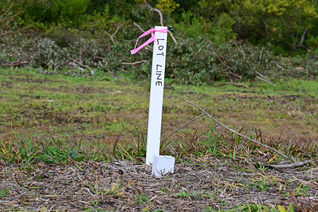
A Title Re-Establishment Survey (often called a boundary survey) redefines the true position of your property boundaries using your Certificate of Title and historic survey records.
This is the survey you typically need when:
We visit your property, locate and re-establish the boundary, mark key points on site and prepare a certified plan that can be used by councils, fencing contractors, lawyers and Land Use Victoria.
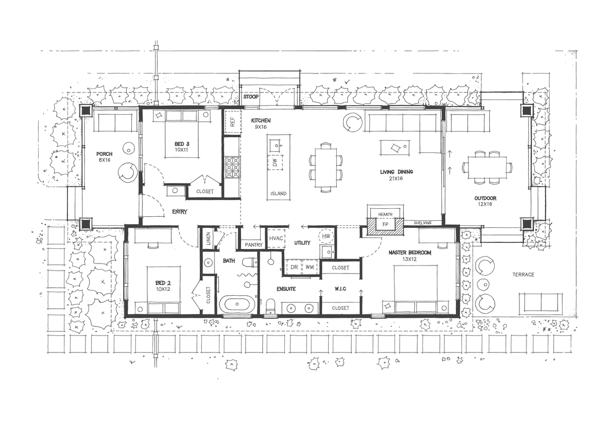
Feature & Level Surveys (also known as topographic surveys) capture the existing conditions of your land – including levels, buildings, trees, driveways, visible services and neighbouring information.
These surveys are commonly requested by:
We supply plans with spot levels, contours and AHD datum in both PDF and CAD formats so your design team can start work immediately.
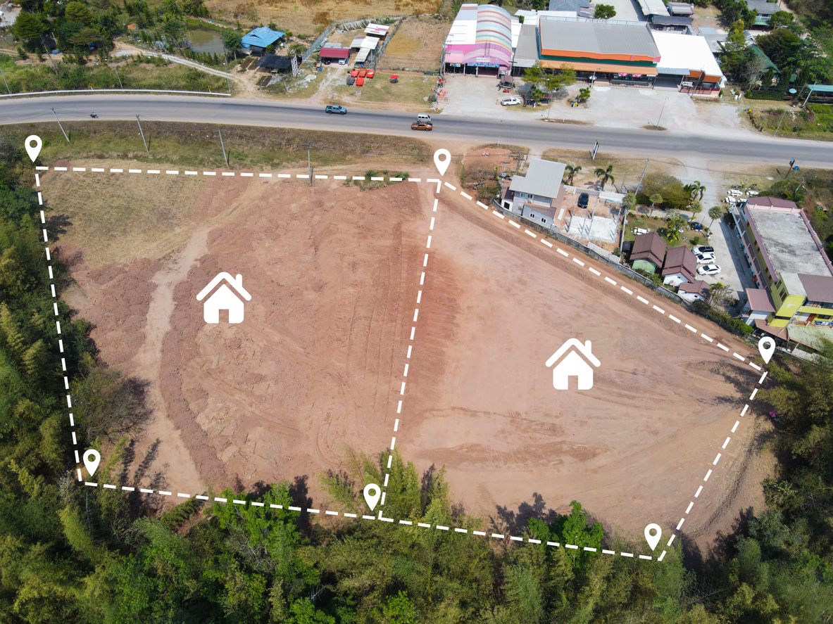
If you are planning to create additional lots, adjust a boundary or combine titles, you will need subdivision surveying and plans of subdivision.
We assist with:
Our surveyors prepare the necessary subdivision plans, work with your town planner and liaise with council and Land Use Victoria so the process moves from concept through to registration as smoothly as possible.
Accurate set-out is critical once construction begins. We provide:
Our field crews use precise instruments and follow strict procedures so you can pour, build and certify with confidence.
Some projects need more specialised survey support. North West Land Surveyor offers:
These surveys are prepared to meet the requirements of councils, lawyers, valuers and Land Use Victoria, providing the documentation you need for legal or commercial decisions.
Not everyone knows the name of the survey they require – and that’s completely normal.
Tell us what you’re planning,such as:
We’ll explain, in straightforward terms, which survey is appropriate, what’s involved and what it will cost, so you can make an informed decision without the jargon.
Yes. Only a Licensed Land Surveyor can legally carry out cadastral (boundary) surveys in Victoria, such as Title Re-Establishment and Subdivision Surveys. Using someone who is not licensed can result in your plans being rejected or challenged. At North West Land Surveyor, all boundary-related work is overseen and certified by Licensed Surveyors.
The fee depends on things like the size of the land, how accessible the boundaries are and how complex the title history is. For typical residential properties in Melbourne’s north and west, most boundary surveys fall somewhere between $1,000 and $2,500. We assess your site and then provide a fixed quote before you commit.
For standard residential jobs, we can usually complete fieldwork and prepare plans within about 5–10 business days after we have all necessary title information. Urgent construction set-outs or fence checks can sometimes be scheduled sooner. Larger subdivisions or complex projects take longer due to council and referral requirements, and we’ll outline timeframes at the quoting stage.
If you want to be certain the fence is on the correct title boundary, yes. Existing fences are often not in the right place. A boundary survey ensures the new fence is correctly positioned, helping you avoid disputes, unwanted notices and the cost of moving a fence later.
We service most of Melbourne’s northern and western suburbs, including Essendon, Niddrie, Keilor, Coburg, Brunswick, Glenroy, Sunbury, Craigieburn, Melton, Caroline Springs, Sunshine, Werribee, Hoppers Crossing, Point Cook and surrounding areas. If you’re nearby and not sure, just get in touch and we’ll let you know if we can assist.
Yes. Alongside preparing the Plan of Subdivision, we can coordinate the survey component of the permit process with your town planner and council. We also liaise with Land Use Victoria at the registration stage. You still retain your planner and other consultants, but we make sure the surveying side runs smoothly.
We do. Many of our regular clients are architects, building designers and small-to-medium builders who use us for feature & level surveys, set-outs and as-built plans. We provide clean PDF plans plus CAD files (DWG/DXF) so your design and engineering teams can plug our data straight into their software.
A feature survey records what’s on the site – buildings, fences, trees, driveways, visible services and relevant neighbouring details. A level survey focuses on ground levels and contours to show how the land falls and where drainage issues might occur. In practice, councils and consultants usually ask for a combined Feature & Level Survey, which we provide as a single comprehensive plan.
An As-Built (or as-constructed) survey is often needed at the end of a project to prove that works have been built in accordance with approved plans. Councils, engineers and building surveyors might request it for items such as buildings, drainage, services or roadworks. We capture the finished positions and prepare plans so you can demonstrate compliance.
Yes. We frequently prepare surveys for easement creation or removal, and for adverse possession or encroachment cases. These plans support your solicitor or planner when lodging applications with council or Land Use Victoria and provide clear, measurable evidence of the land in question.